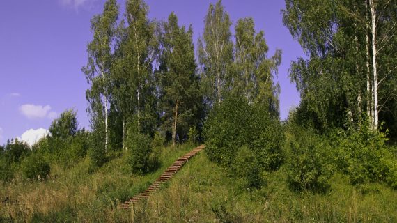
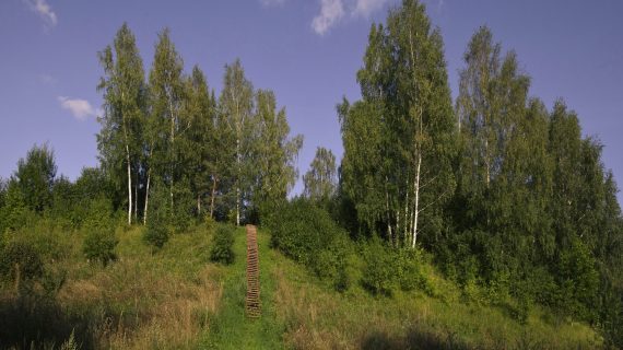
Maneičiai hillfort
The hillfort dates back to the 1st millennium – the beginning of the 2nd cent. Mineičiai Hillfort is also known under the name Sudeikiai. It is situated on a separate hill, 150 m eastwards from the eastern shore of Lake Alaušas. The site is square in shape, size 30×18 m. Some lined and rough ceramics have been found in it during the investigations. On the southern edge there is a 0.4 m high, 6 m wide earthwork. 2 m below the southern edge of the site there is a 9 m wide terrace, behind which there is a 6 m wide, 0.2 m deep ditch. The second 0.3 m high, 5 m wide earthwork is across the ditch. Behind this earthwork there is the second 4.5 m wide, 0.2 m deep ditch, the third 0.4 m high, 7.5 m wide earthwork and then the third 6 m wide, 0.2 m deep ditch. Southwards across the ditch there is an earthwork-shaped natural 1.5 m high elevation. On the northern slope, 4 m below the site there is a 9 m wide terrace. The slopes are steep, 10 m high.
The hillfort was destroyed by ploughing that ruined its earthworks. At the end of the 19th cent. 4 earthworks were mentioned: two larger on both edges of the site and the smaller ones on the slopes. It is mentioned that from the eastern aspect there was a 6.5 wide entrance to the hillfort and it was protected by 23 m long, 1.4 high earthworks. The foot settlement of the area of 7 ha was around the hillfort where fireplaces, molded ceramics, clay plaster and bonfire sites have been found during the investigations in 1996.
Legend has it that in olden times there was a church and fortifications of Lithuanian dukes on Maneičiai Hillfort.
Information
Maneičių village, Utenos dist.
Gallery